The man who traces the streams
Published: Oct 17, 2023 Reading time: 10 minutes Share: Share an articleOne day, IT specialist Daniel Pánek became an environmentally engaged citizen. He decided to become active when he could no longer just watch the worsening drought in the surrounding countryside.
He started with the stream that runs through his village and made his way to its source. Eventually, he mapped its entire watershed, visited several villages, and became one of the most active people in the fight against the Central Bohemian drought. The activities of the LIFE WILL - Water in Landscape and Soil project are based on the data he collected.
Landscape mappers are the indispensable initial links in the participatory project LIFE WILL - Water in Landscape and Soil, in which we cooperate with Beleco and the Association of Local Authorities in Central Bohemia. Daniel Pánek was also an early actor in the landscape restoration story when he started mapping the landscape around Veltrub and Němčice. Eventually, he will also author a study proposing landscape measures around Němčice.
What ills of the Elbe region landscape did Daniel Pánek discover? What details did he delve into during his studies to understand his home landscape? And when do the interests of birds and landscape come into conflict? Find the answers in the following interview.
How did you get into mapping?
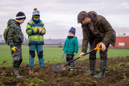
In the beginning, I just watched the deepening drought and wondered why nobody was doing anything about it when something could be done so easily. So, I started looking around a bit, so as not to be all talk, and signed up for a training course on landscape mapping. I started mapping our stream and followed it from Veltrub to Němčice, where it rises.
I have mapped the whole area with the idea that I would probably approach the municipalities, or the owner of a large plot of land, to see if they would be interested in doing something about the problem. Coincidentally, a friend of mine is the vice-mayor of Němčice. We all talked it over and concluded that they would be interested because they wanted to restore the roads and plant vegetation, but they didn’t know exactly where to do so. They were afraid that they might choose the wrong locations and make things worse. They wanted it to happen and also make sense.
So at some point, your interests collided.
This all fell into place nicely, and the fact that it started with Němčice is a confluence of several circumstances. The council here is united in the fact that people feel close to the nature around them. So we agreed that, for a nominal fee, I would conduct a study.
How time-consuming has it been for you from the beginning till today?
I spent three or four weekends doing mapping training, then I was out in the countryside, which were mostly half-day trips. Over the course of three years, I have spent several weeks doing this.
Then I traced the historical context of the landscape development. I studied old maps, searched in archives, looked at aerial maps, sat at the computer to look for which pond was where, where it was waterlogged...
So is the landscape history included in the feasibility study?
Also, because the basis of waterways is still the same in the landscape. Unless people disturb them with their activities, the water continually flows the same way. Major influences on water retention include land reclamation, erosion, soil degradation, and deforestation.
So generally, is the tendency to go back to the way things were and not invent anything new?
The aim is not to invent something for nature but to allow it to return to where it has historically been running. Historic maps show, for example, the valleys and the grassy, saturated meadows around them, which are now partly ploughed and drained. Whereas in the past they naturally retained moisture in the landscape.
Today, the field is ploughed in such a way that when it rains, none of the water is retained in the ground, it all just runs off immediately.
We're standing just down the street from the sewage treatment plant. It's quite humid and there's a lot of vegetation. What's around here?
There are springs and four gullies which are supplied with water in various ways. Water from land reclamation and the stormwater drainage system is channelled into them. Where the oaks and willows are, there used to be a pond about 200 years ago, but a former dam destroyed it. The LW project intends to partially restore it.
Here the four streams flow down, but you can see that the water just flows out of here through the modified concrete bed of the Bačovka, which is basically the main drainage facility.
How challenging was the mapping process for you as an IT specialist?
I grew up in a village and I have a degree in agriculture, so from that point of view I am quite close to the cultural landscape. It's mapped on the phone, so anyone can take pictures. Archival maps are digitized, then transferred to a PC program - this makes things easier for the programmer.
That means you've actually merged two areas of expertise. How challenging could it be for someone who doesn't have that background?
That's the question. Sometimes I really wonder what my mom could do with her phone... It's not something that, say, any high school student couldn't learn relatively quickly.
So you wouldn't discourage anyone from doing it?
It is important to have a feel for mapping and a broad awareness of the issue. It is sometimes hard to understand what the water is actually doing when it is flows - whether it is seeping in, just running off the surface, or if some gully is taking it away and causing erosion. That's why I sometimes take a raincoat and boots and go mapping in the rain.
Does mapping require a willingness to be uncomfortable?
Well, it's better to just go for it. Some years, the landscape is arid. And then the next year, when it rains all the time, the same place is completely different and waterlogged. In some areas the water is retained, while in others, it washes away causing erosion and not everyone realises this. When you map a stream, you need to see how it behaves when it's dry and when it’s wet. You need to see what the surrounding soil is like, where the water is seeping in, and if the stream redirects its flow when the water level reaches a certain height.
It is also good to ask the locals, especially farmers, who of course know a lot about water in their countryside.
Is it important to capture the landscape throughout the year?
I guess so. Here in Polabí, the ground hasn't even frozen in recent years, whereas it used to freeze up to half a metre. Snowmelt is also a rare thing here nowadays. Sometimes it is dry in January, sometimes it is waterlogged. Sometimes it's dry in July, sometimes wet. You have to be aware of the effects of snow in winter or torrential rain in summer - whether the water soaks in or runs off. It takes some intuition and imagination to assess it all correctly.
And I guess you have to know a little bit about that particular landscape, don't you? If you went mapping in the Podkrkonoší region, for example, it would probably be harder to map...
I'm sure it depends on previous knowledge, but paradoxically I find it easier in the mountains. On the slopes, the water concentrates into paths and runs off quickly. You can imagine which way it will flow and where it will be held back by a mound. Whereas here, for example, you have to view satellite images or be in the field at the right place and time to see where it is waterlogged, where there are tractor tracks, etc. It is not always clear at a glance which direction the water will flow.
You have mapped a large part of the region, so if the municipalities around Němčice want to get involved, you have enough already prepared. Would you be interested in continuing cooperation with them?
If representatives of any of them would like to discuss this further, we can, of course.
These measures are mainly carried out on agricultural land, so the biggest problems come from the owners and the attitudes of the people who manage the land. It takes many cities a year just to negotiate something. In Němčice, they have the advantage of owning quite a lot of their land.
How has being involved in landscape restoration changed your life?
Not significantly. I've put some time into it, I take nominal payments, but it's an interesting experience. You get to go on field trips sometimes where you get to see people from the village and the farmers. You learn new things and get to know people around you. And you walk around and get to know the countryside.
What have you learnt from your experience?
I think farmers often get a bad rap, but they’re not that bad. Some people feel that they are just mining the countryside to death and destroying it. That might often be true, but it's case by case. And even people who I wouldn't have assumed would care go through various training courses and gradually learn to work with the landscape because they know they need water and nutrients, and today there's less in the soil.
Again, activist groups sometimes have the idea that farmers should not be using fertilisers, should not be using sprays, should not be doing certain types of ploughing, etc. But no one can say for sure which is the best practice yet, because every field is different and some practices make more sense in some places than in others. You have to know how to work with what you have and respect the other side. Finding the optimal method is very difficult.
Have you met a wide range of farmers?
Those who are interested usually come to the meetings, and I've often been surprised at how knowledgeable they are. I wouldn't presume to advise them. They do a lot of things well, and I'm often surprised by their solutions.
Has the development of the LIFE WILL project met your expectations so far?
Although there is a lot of talk about water retention in the landscape, I don't see anyone, politicians for example, who would push for this and create more favourable conditions so that these measures can be done to a greater extent. The owner’s rights are significant and the state is offering temporary fixes rather than long-term solutions. It is disappointing.
As far as my designs are concerned, I have done what I consider feasible in the landscape. But because I'm not an expert in hydrology, I haven't always got it quite right.
Do you have a specific example?
I do, it involves ornithology. In one location, where water is retained in a field, I planned for a wetland over intermittent drainage. Part of the project involves conducting a biological survey. And right away we came across several endangered northern lapwing, a rare and pleasant surprise in that area. So, we'll probably try to work with the landowner to maintain a regime suitable for nesting, for which there is a programme designed to protect this endangered species. An overgrown wetland would be undesirable.
So, some kind of corrective action is appropriate.
Yes, I'm sure. The work is meaningful. It needs to be talked about to get it out to the people. Well, let's propose ten measures, three will be useless, one will be bad, and six will be good, and we will have a guide for next time to let us know what to avoid.
Do you expect to continue mapping?
I'm not sure yet, but it's likely. It will depend on how busy I am. But if I see some results after all these years, there will be motivation to continue.
This interview was created with the financial support of the European LIFE program, co-financed by the Ministry of the Environment and the Central Bohemian Region.